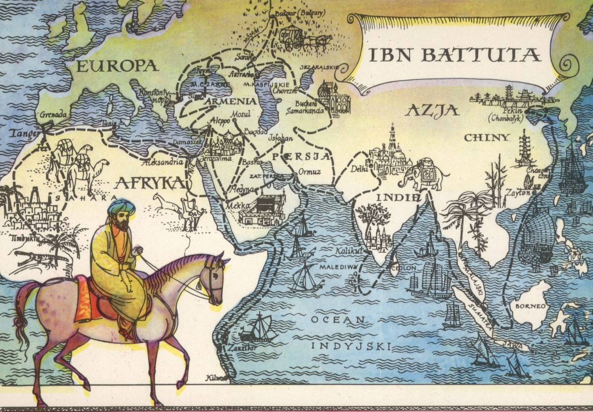
Ibn Battuta, born in 1304 CE, was a Moroccan explorer and scholar. Over 30 years, he travelled 125,000 kilometres, across 40 present-day countries, the longest distance traveled by a single human until the 19th century.
Ibn Battuta belonged to the Amazigh (Berber), an ethnic group native to Northwest Africa, and he trained early on as a legal scholar and judge. At age 21, alone on a donkey, he left his hometown of Tangier, Morocco, to go on pilgrimage to Mecca, Saudi Arabia. Fascinated by what he saw and learned, he continued to explore, visiting and living in present-day Iran, Yemen, Tanzania, Uzbekistan, India, Indonesia, China, Turkey, Mali, and Spain, among others.
He was curious about every aspect of these lands, from history, society, economy and politics to daily lives and customs of people, from inventions, architecture and art to trees, animals and natural resources. He reported on south-to-north flow of River Nile, strict laws against theft in Turkey, and high-quality fabric and thriving economy in Mogadishu, Somalia. He told of beauty of the pearls in Sri Lanka, fairness and objectivity of courts and salt-mining in Mali, and huge size of chickens and ships and precision of portraiture in China. Also reported were coral stone palace, indoor plumbing and careful city-planning of Kilwa, Tanzania, brutal cold of Hindu Kush mountains in Afghanistan/Pakistan, and great generosity of people of Damascus, Syria.
Ibn Battuta’s personal experiences were as wide-ranging and extraordinary as places he visited. He met almost 60 rulers and hundreds of other dignitaries, studied with Sufi saints and jurists, married some women and fathered many children. He was also attacked and robbed of everything by raiders, nearly beheaded by a king, survived wars and rebellions and almost drowned in a sinking ship. A detailed account of his adventures is titled “Rihla”, or “Travels”.
wrote by Rahim Mawji at buyuafrika.wordpress.com
[ads2]


Hi,
I was wondering why is this map written in a different language?
Where is the map from? Also, do you know what language it is?
It is curious. Do you know anything about that picture map?
Could You please Help
it is most likely Berber due to the fact that Berber is the main language of Morocco and has been for thousands of years and some of the cities went under different names like how zayton is now quanzhou and ardyan is now riyadh